 Name: The Railway Walk Name: The Railway Walk
Route: Rowlands Castle to Petersfield
First Walked: 21 June 2017
Distance: 11.9 miles
Steps: 29,957
Time: 4 hours
Comments: It takes ten minutes to get from Petersfield to Rowlands Castle, then four hours to walk back!
One of my favourite walks with lovely views over the countryside - and the London to Petersfield railway line, hence the name.
|
|
 |
|
|
|
 |
|
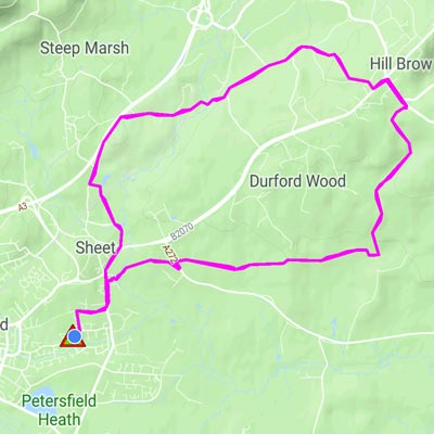
 Name: The Jolly Drover Name: The Jolly Drover
Route: Petersfield - The Jolly Drover - Petersfield
First Walked: 28 June 2017
Distance: 8 miles
Steps: 17,513
Time: Not recorded
Comments: This walk accompanies the River Rother at various places and crosses the Portsmouth to London Railway line a couple of times.
One footpath near the end of the walk become clogged with ferns and stinging nettles in June. |
|
|
|
 Name: Midhurst Name: Midhurst
Route: Midhurst to Petersfield
First Walked: 5 July 2017
Distance: 12.9 miles
Steps: 28,149
Time: Not recorded
Comments: This walk involves catching a bus to Midhurst then walking back. It is not one of my favourite walks and I've done it once or twice. |
|
|
|
|
|
 |
|
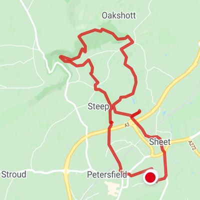
 Name: Shoulder of Mutton Name: Shoulder of Mutton
Route: Petersfield - Shoulder of Mutton - Petersfield
First Walked: 13 July 2017
Distance: 8.08 miles Steps: 17,660
Time: Not recorded
Comments: This has become a firm favourite with Cobbetts View literally the highlight! |
|
|
|
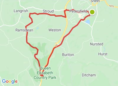
 Name: Butser Hill Name: Butser Hill
Route: Butser Hill - Ramsdean - Petersfield
First Walked: 20 July 2017
Distance: 11.2 miles
Steps: 25,410
Time: Not recorded
Comments: At the start a rather boring walk, mainly along paved foorpaths beside the old A3 to Queen Elizabth Country Park - then a slog up Butser Hill!
|
|
 |
|
|
|
|
|
 Name: South Harting Name: South Harting
Route: South Harting - Petersfield
First Walked: 24 July 2017
Distance: 7.59 miles
Steps: 16,613 steps
Time: Not recorded
Comments: A bus to South Harting then a walk along the South Downs Way to Buriton and home. |
| |
|
|